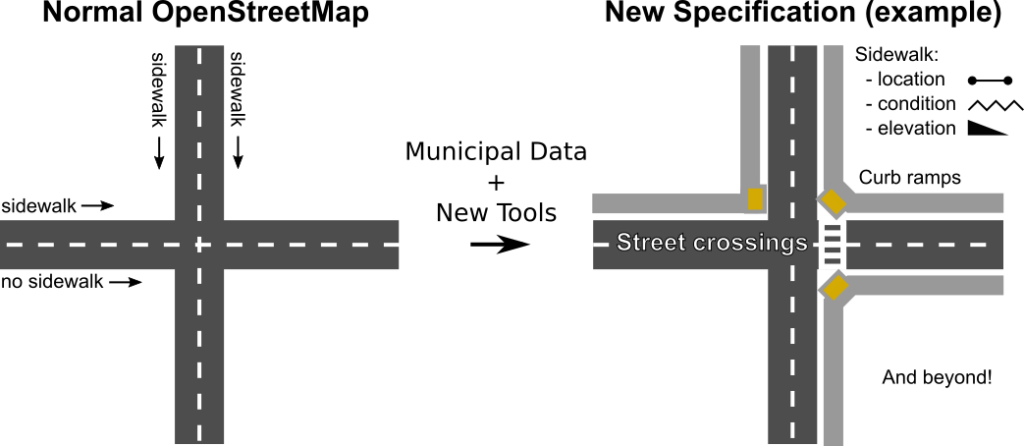
OpenSidewalks seeks to make pedestrian ways, like sidewalks, first class members of an open, routable transportation network from which we can ask a variety of important questions. This means collecting a connected network of path types with detailed attributes like width, surface composition, steepness, and shared traffic.
The OpenSidewalks data schema defines an in-development specification for the mapping and use of pedestrian network data. It is intended to be a flexible format that can be populated from many different data sources, including OpenStreetMap, from which it is heavily inspired. Mapping pedestrian paths in OpenStreetMap using the rules of the OpenSidewalks standard (with a few caveats) will generate OpenSidewalks-compatible data.